About

Live Map
Vehicle positions on the map may differ from their actual location by up to 10 seconds. Tap a vehicle to see more information about it. Data sourced from TLT, Elron and GoBus (Tartu).
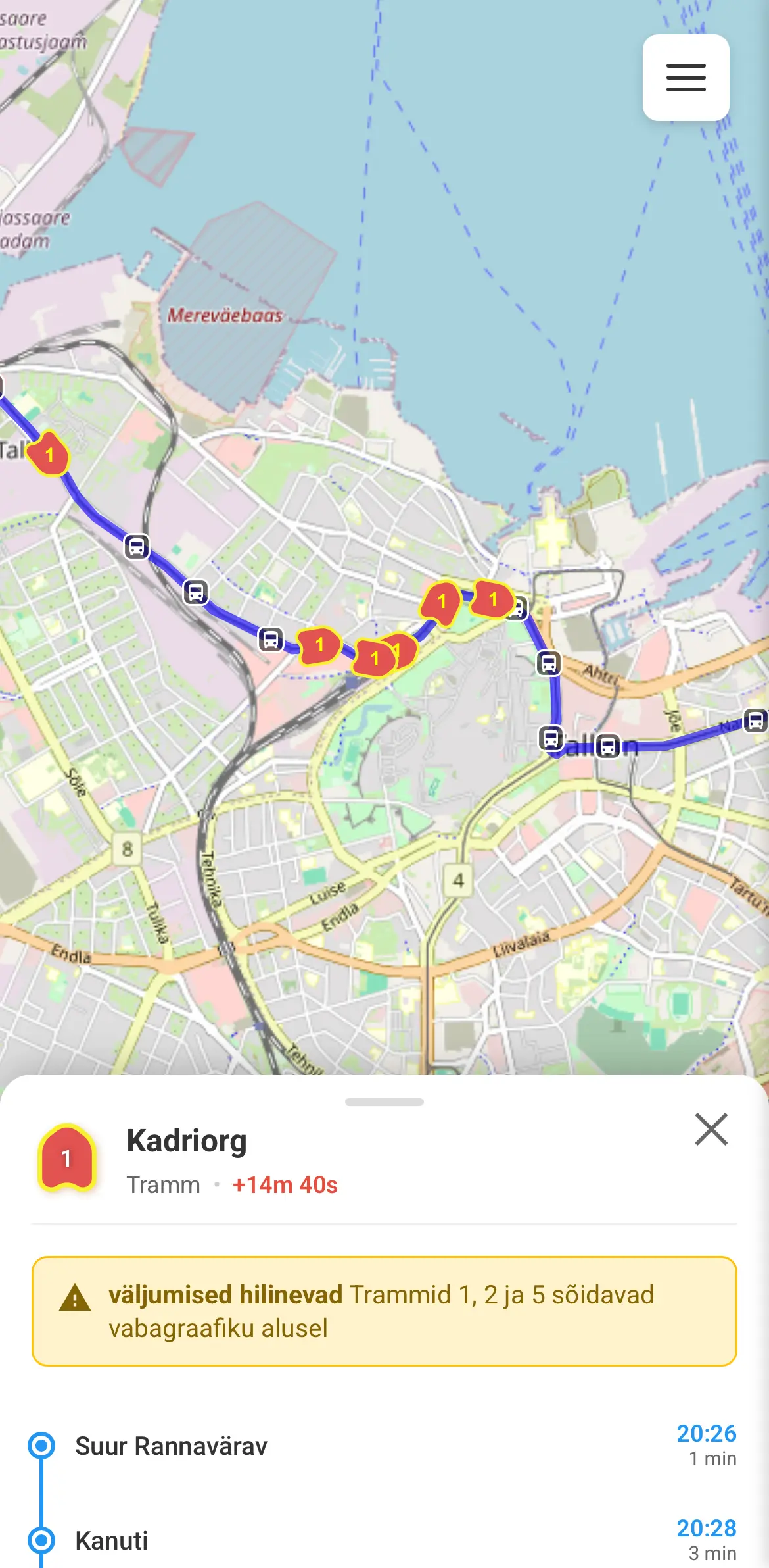
Vehicle Info
Tap a vehicle to see its current delay, disruption info, next stop, and planned route changes. The route and stops are also shown on the map.
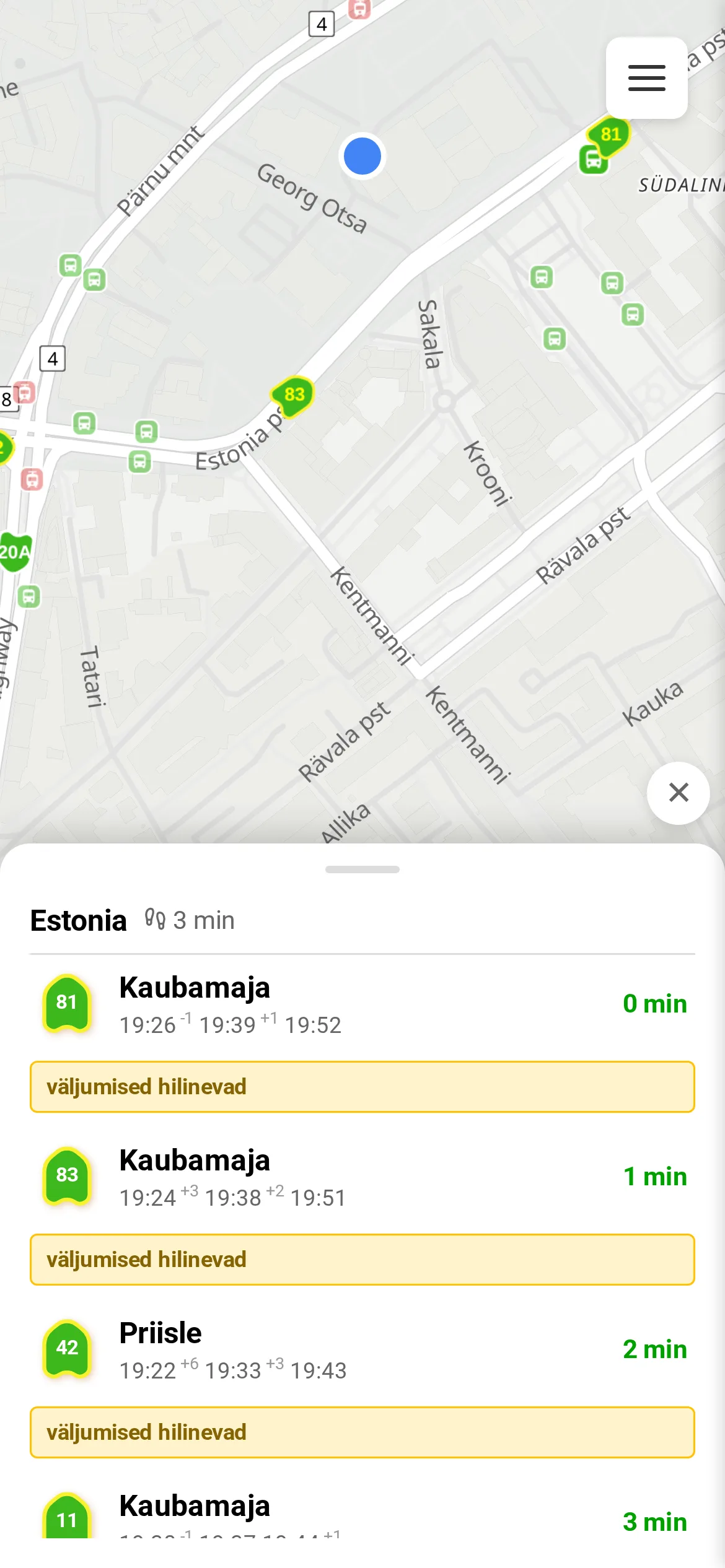
Stop Info
Tap a stop to see the current delay of vehicles stopping there, along with disruption info and planned route changes. Only vehicles stopping at that stop are shown on the map. Select a route to see a quick overview of its path.
Green min means the vehicle is that many minutes away, based on live GPS data.
Gray min means no GPS data is available and the vehicle is that many minutes away by schedule.
+1, +2, ... shows how many minutes late a vehicle is. If absent, it's on time or GPS data is unavailable.
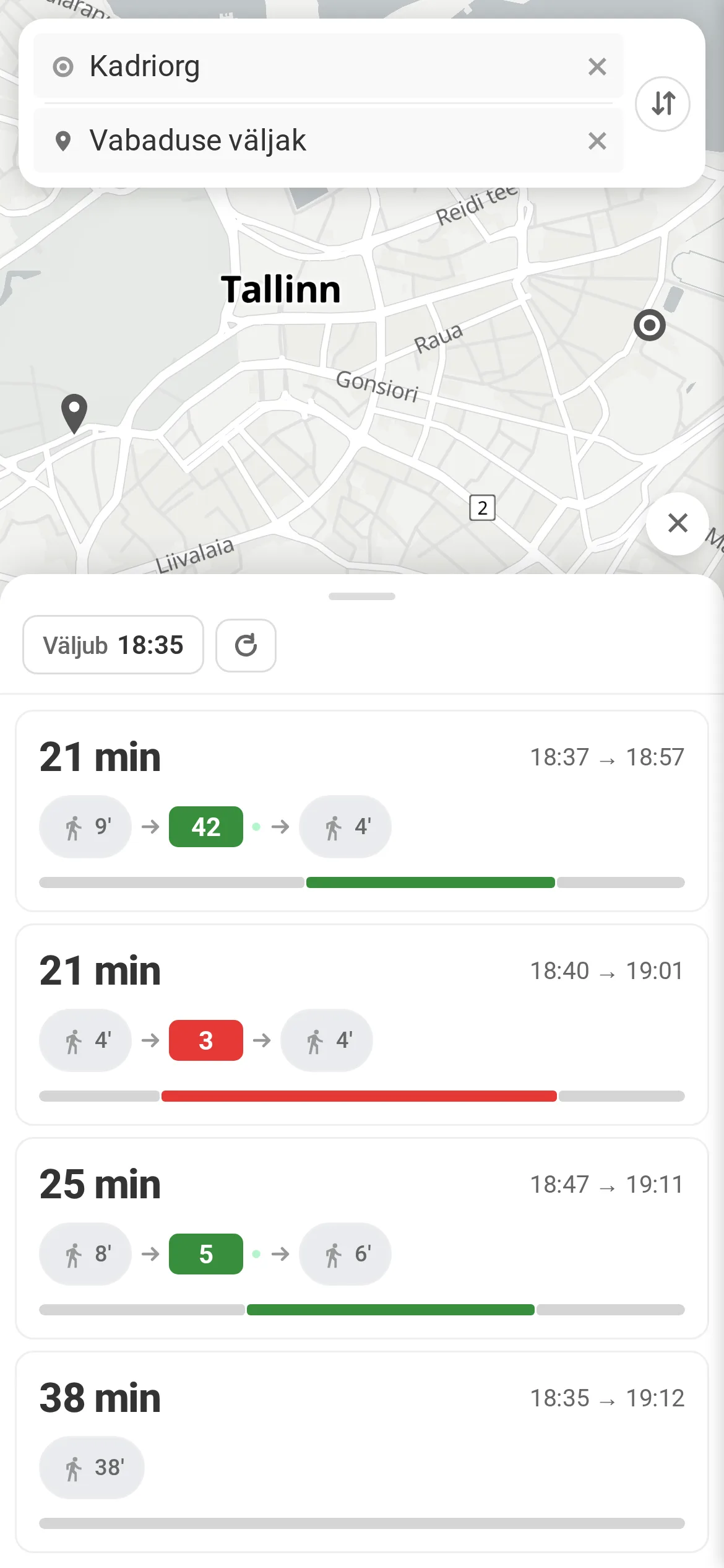
Route Planner
Plan a door-to-door journey. The planner takes live vehicle positions into account — a green dot next to a line means the vehicle is tracked by GPS. Based on recent weeks of delay data, it also estimates the probability of arriving on time.
Add the app to your Home Screen
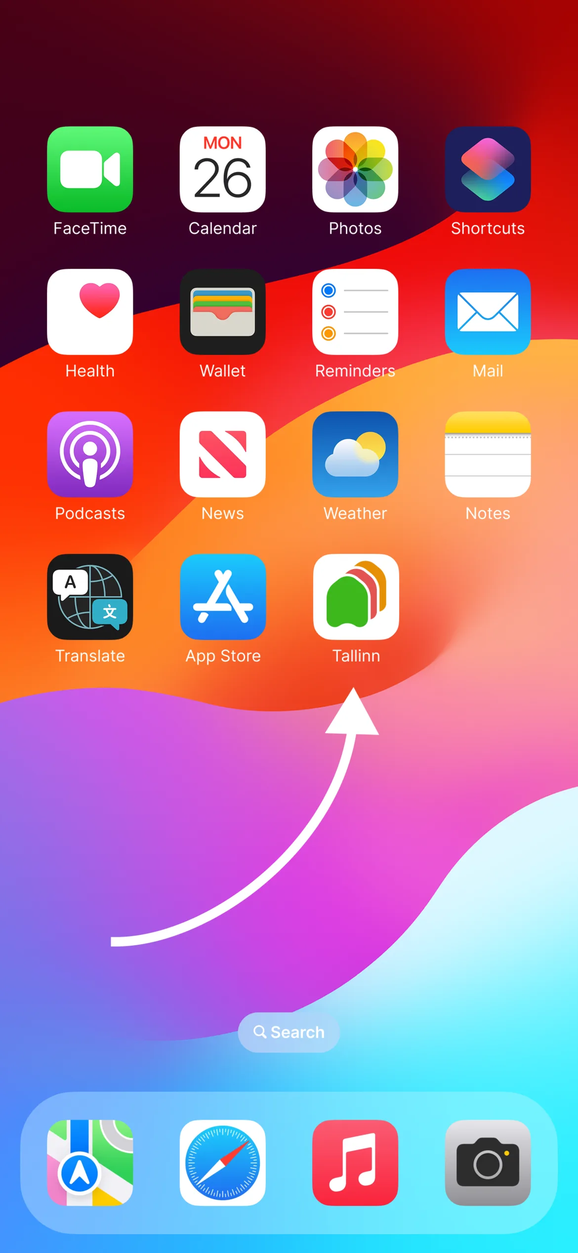
From your Home Screen the map opens full-screen, just like a regular app.